
 |
| https://www.facebook.com/VintageAirPhotos/photos/a.409414512455314.91856.338791092850990/409414515788647/?type=1&theater |
Historical air photos of British Columbia from the 1940's and 1950's. http://vintageairphotos.com
Facebook: https://www.facebook.com/VintageAirPhotos
So from September 1995 to November 1999 I worked scanning aerial photography. If you read the info on the link below you can see how things changed from film to digital. I graduated from Langara's Professional Photography program and after a brief stint on the cruiselines this is where I landed.
Scanning was totally new and we used very expensive high end scanners. I had the pleasure of working with Mark and his dad. I even got to teach Mark's dad how to use the scanners as the darkroom was phased out. I still remember my supervisor Doug, telling me he only wanted to learn from me. Not sure if that was completely true, ha! ha! but I like to think so. I taught everyone that came through the scanning department until I was phased out! :( but I digress!
I saw alot of those old photos in the basement of the building we worked. Once, and I know this is crazy stuff but I quit the company to go work on the Cruiseships...it didn't work out and I came back but was in between apartments. I lived in the basement for about a week...yikes...crazy..I worked the night shift and so I tried (not very successfully) to sleep in the basement during the day.
I learned a lot during the time I worked there...I learned Unix, and how to work on big computers with big files..well they were big then... 40 mb and 100mb were big deals then. Ha! ha!
I burned my first Cd's there...anyways...what I want to share is these great photographic images and how our province has changed. Amazing that it could be captured and now is being shared. You can see it for yourself and even buy a digital or photographic image. http://vintageairphotos.com/
Thanks for sharing these Mark!!
http://vintageairphotos.com/background/
Hi, my name is Mark, and I’ve got a kind of interesting story to tell:
My dad worked in the drafting/survey/mapping industry since the late 1940′s. I’d guess that throughout his career he probably worked for at least six different mapping companies here in the Vancouver, BC, area. That’s not to say that he had a lot of jobs, but rather that mapping companies here seem to change hands like hockey cards at an elementary school. I don’t think 5 years goes by without some mapping company being bought out, changing names, or both. The companies change names but the people remain the same. I know, because I’m in the mapping industry too. I’ve been working with air photos since pretty much the day I graduated high school, that’s coming up on 28 years ago. I even had the pleasure of working with my dad for about 10 of those years.
Read More Here
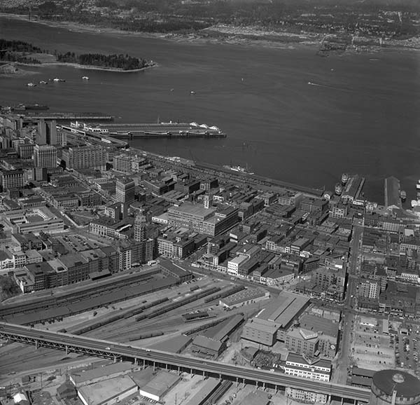 |
| This is the area North of the Georgia Viaduct in Vancouver from 1951. Other streets visible in the image are Hastings Street, Pender Street and Carrall Street. This image has amazing clarity. You can really zoom into the streets. http://vintageairphotos.com/1-133/ |
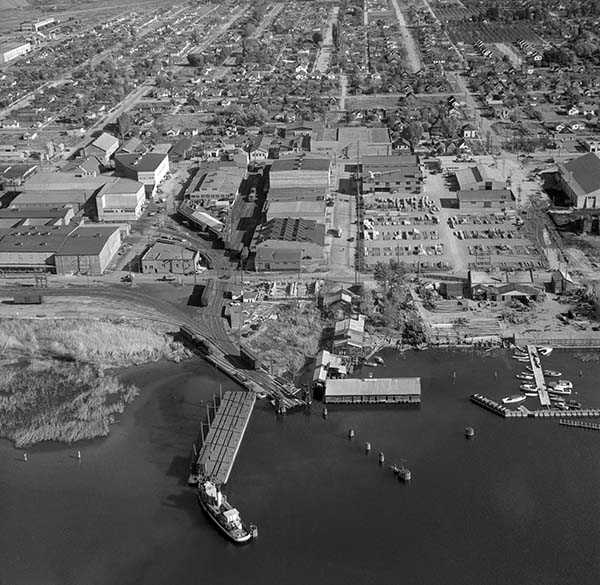 | ||
| The city of Kelowna in 1948 is practically unrecognisable. The street at the front of the picture is Water Street. The next one back is St. Paul Street. http://vintageairphotos.com/bo-48-3567/ |
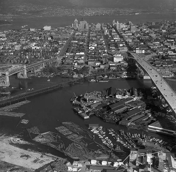 |
| This is Granville Island and part of downtown Vancouver from 1956. This is the “new” Granville Street bridge which is only 2 years old here. http://vintageairphotos.com/bo-56-316/ |
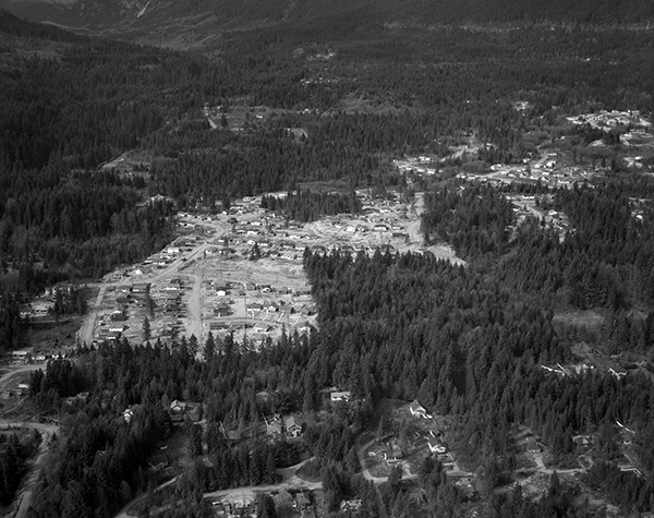 | ||
| This is the Capilano Highlands area of North Vancouver from 1950. To give you a rough idea of where we are, Paisley Road falls near the center of the image. It’s very likely that the Capilano Suspension Bridge is actually toward the top-left corner, but is hidden behind all the trees. http://vintageairphotos.com/bo-50-54/ |


